Swath width calculator
Calculates total swath width on the seabed and minimum slant range for a given sonar altitude and swath angle. Results are theoretical and assume a flat seabed at constant depth.
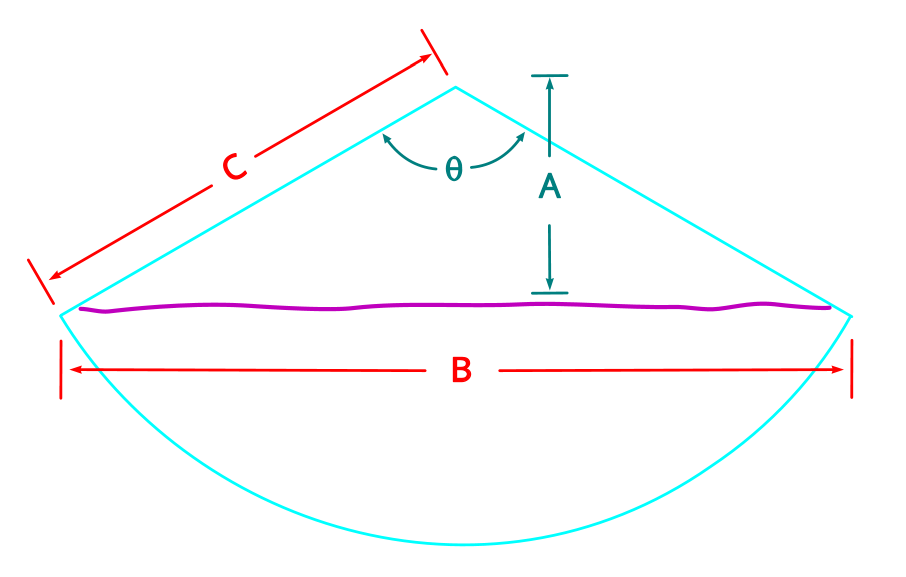
θSwath angle (total) — input
ASonar altitude / nadir depth — input
BTotal swath width on seabed — output
CSlant range to outer beam — output
m
°
B — Total swath width
—
2 × A × tan(θ ÷ 2)
C — Minimum slant range
—
A ÷ cos(θ ÷ 2)
These calculators are informational tools provided without warranty or cost. Results are theoretical and assume a flat seabed at constant depth. Do not rely on this tool when planning any survey where financial or safety factors are present. MosaicHydro is not responsible for any errors, omissions, or decisions made in reliance on these results.