Sidescan sonar
Efficient Line Planner
Calculate intra-pair and inter-pair line spacings that eliminate redundant overlap, cutting data acquisition time by over 35% compared to traditional single-line methods.
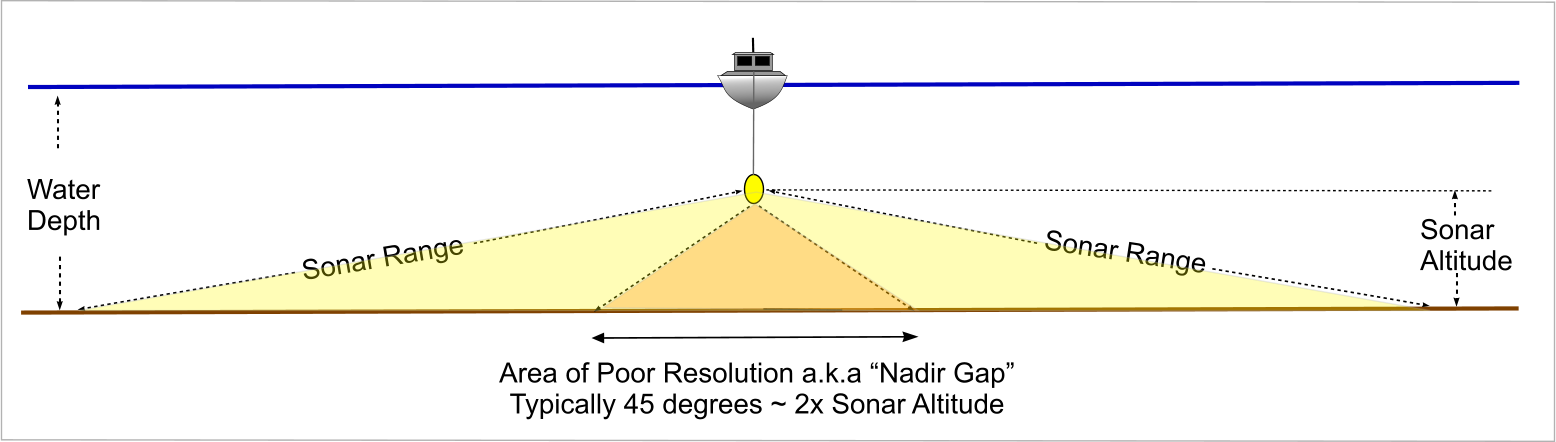
Sonar Settings
Range: 0.1 – 1,000 | Ground units
Range: 5 – 5,000 | Ground units | Must be greater than sonar altitude
Sonar range must be greater than the sonar altitude.
Ground Range
auto
—
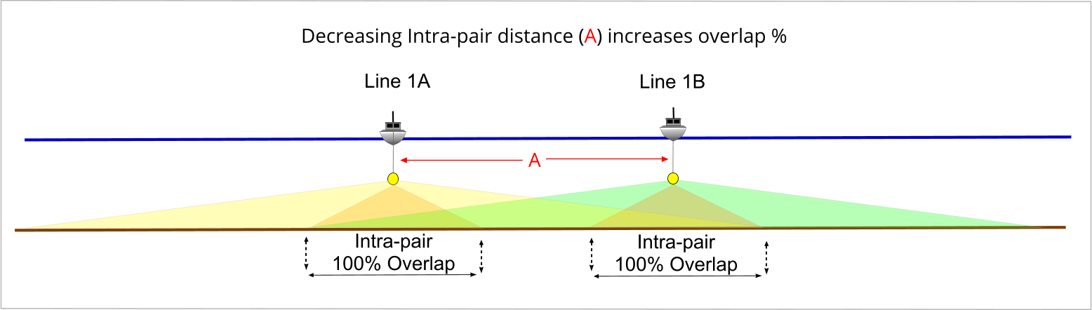
Intra-pair Settings
Range: 0 – sonar altitude | 0 = perfect line keeping
How well your boat driver keeps to the survey line, in ground units. This value cannot exceed the sonar altitude.
Boat driver ability cannot exceed the sonar altitude.
Intra-pair Overlap
auto
—
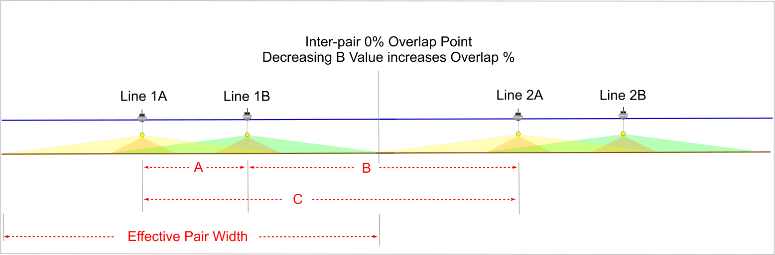
Inter-pair Settings
Range: 0 – 50
Inter-pair Calculated Overlap (ground units)
auto
—
Boat driver line keeping ability is incorporated into this calculation.
Results
Intra-pair Distance — A
—
Inter-pair Distance — B
—
Line Planning Tool Offset Value — C
C = A + B
—
Effective Pair Width
Use this to calculate how many line pairs cover your survey area.
—
These results are informational only. The efficient line planning method assumes consistent sonar altitude, a flat seafloor, and equidistant coverage from the nadir. Actual coverage will vary with topography, vessel motion, and sonar performance. MosaicHydro accepts no liability for decisions made based on this tool.